
WITHIN THE PAST FEW HOURS…HURRICANE IAN HAS SEVERELY INTENSIFIED.
GOING FROM 120 TO 155 MILE PER HOUR WINDS.
JUST SHY OF CATEGORY FIVE STRENGTH OF 157.
IT’S STILL EXPECTED TO MAKE LANDFALL IN FLORIDA AS A VERY STRONG CATEGORY FOUR THIS AFTERNOON.
HURRICANE IAN IS SETTING A CATASTROPHIC STAGE WITH STORM SURGES PREDICTED TO BE BETWEEN 10 AND 16 FEET DEEP.
IAN IS NOW TRACKING MORE SOUTH FROM IT’S PROJECTED PATH FROM YESTERDAY.
ORIGINALLY PROJECTED FOR TAMPA…NOW IAN WILL LIKELY INTERCEPT CLOSER TO FORT MYERS.
GOVERNOR DESANTIS TELLING RESIDENTS THIS MORNING ITS NO LONGER SAFE TO EVACUATE AS TIME IS RUNNING OUT.
IAN ALREADY CROSSING OVER CUBA.
THE ENTIRE ISLAND SITTING IN THE DARK TODAY AS IAN KNOCKED OUT THEIR ELECTRICAL GRID.
AFTER CROSSING CUBA…IAN SLOWED IN THE GULF ALLOWING IT TO GAIN MORE MOMENTUM.
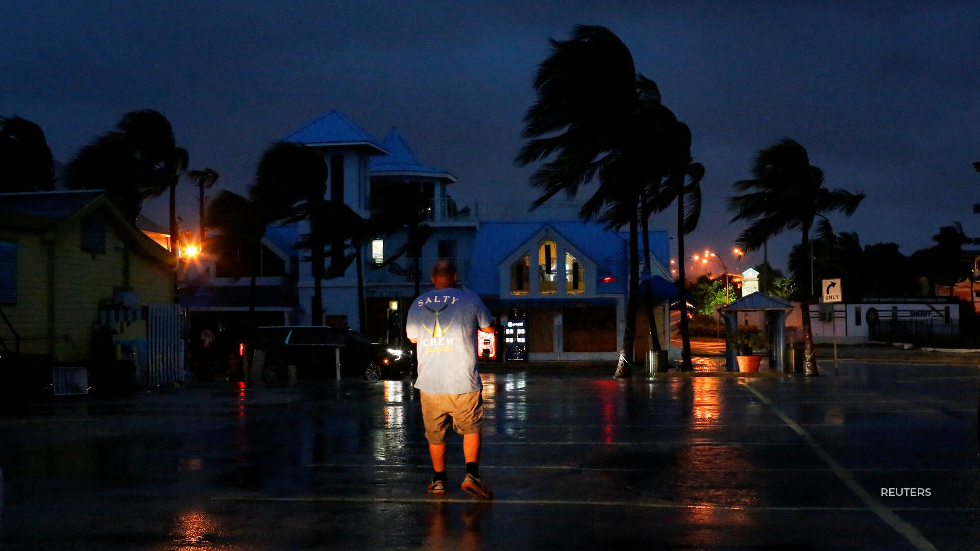
THE OUTER BANDS ARE ALREADY BEING FELT BY THE KEYS AS IT SLOWLY MOVES IN.
IT’S ALSO LIKELY TO BE COSTLY.
PROJECTED TO BE MORE THAN 70 BILLION DOLLARS WORTH IN DAMAGES.
AS HURRICANE IAN TEETERS ON THE VERGE OF A CATEGORY FIVE…
THE STORM IS PROJECTED TO DEVASTATE THE SUNSHINE STATE.


MOST POPULAR
-
 Getty Images
Pythons decimate Florida’s wildlife, is eating them the answer?
-
 Getty Images
Trump could lose Secret Service protection if found guilty
-
 AP Images
Argentina asks to join NATO as Milei looks to enhance security, strengthen ties
-
 Getty Images
Utah students protest 'furries,' school admin deny problem